


WATER Voting District, Brown County, Wisconsin
About
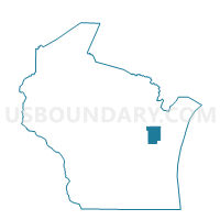
Outline

Summary
| Unique Area Identifier | 692492 |
| Name | WATER Voting District |
| County | Brown County |
| State | Wisconsin |
| Area (square miles) | 80.88 |
| Land Area (square miles) | 0.00 |
| Water Area (square miles) | 80.88 |
| % of Land Area | 0.00 |
| % of Water Area | 100.00 |
| Latitude of the Internal Point | 44.61831560 |
| Longtitude of the Internal Point | -87.92134720 |
Maps


Graphs
Select a template below for downloading or customizing gragh for WATER Voting District, Brown County, Wisconsin


Neighbors
Neighoring Voting District (by Name) Neighboring Voting District on the Map
- ABRAMS - T 9999 Voting District, Oconto County, WI
- Green Bay - C 1 Voting District, Brown County, WI
- Green Bay - C 22 Voting District, Brown County, WI
- Green Bay - C 24 Voting District, Brown County, WI
- Green Bay - C 25 Voting District, Brown County, WI
- Green Bay - C 29 Voting District, Brown County, WI
- GREEN BAY - T 2 Voting District, Brown County, WI
- Howard - V 6 Voting District, Brown County, WI
- LITTLE SUAMICO - T 1 Voting District, Oconto County, WI
- RED RIVER - T 1 Voting District, Kewaunee County, WI
- SCOTT - T 1 Voting District, Brown County, WI
- SCOTT - T 4 Voting District, Brown County, WI
- SUAMICO - T 1 Voting District, Brown County, WI
- SUAMICO - T 2 Voting District, Brown County, WI
- SUAMICO - T 7 Voting District, Brown County, WI
- UNION - T 1 Voting District, Door County, WI
Top 10 Neighboring County Subdivision (by Population) Neighboring County Subdivision on the Map
- Green Bay city, Brown County, WI (104,057)
- Howard village, Brown County, WI (17,399)
- Suamico village, Brown County, WI (11,346)
- Little Suamico town, Oconto County, WI (4,799)
- Scott town, Brown County, WI (3,545)
- Green Bay town, Brown County, WI (2,035)
- Red River town, Kewaunee County, WI (1,393)
- Union town, Door County, WI (999)
- County subdivisions not defined, Oconto County, WI (0)
Top 10 Neighboring Place (by Population) Neighboring Place on the Map
- Green Bay city, WI (104,057)
- Howard village, WI (17,399)
- Suamico village, WI (11,346)
- Dyckesville CDP, WI (538)
Top 10 Neighboring Unified School District (by Population) Neighboring Unified School District on the Map
- Green Bay Area School District, WI (136,070)
- Howard-Suamico School District, WI (28,500)
- Luxemburg-Casco School District, WI (11,083)
- Oconto Falls School District, WI (10,846)
- Southern Door County School District, WI (8,044)
- School District Not Defined (Water), WI (0)
Top 10 Neighboring State Legislative District Lower Chamber (by Population) Neighboring State Legislative District Lower Chamber on the Map
- Assembly District 89, WI (58,999)
- Assembly District 88, WI (58,089)
- Assembly District 90, WI (56,344)
- Assembly District 1, WI (54,189)
Top 10 Neighboring State Legislative District Upper Chamber (by Population) Neighboring State Legislative District Upper Chamber on the Map
Top 10 Neighboring 111th Congressional District (by Population) Neighboring 111th Congressional District on the Map
Top 10 Neighboring Census Tract (by Population) Neighboring Census Tract on the Map
- Census Tract 1013, Oconto County, WI (8,785)
- Census Tract 9604, Kewaunee County, WI (8,589)
- Census Tract 202.03, Brown County, WI (6,367)
- Census Tract 201, Brown County, WI (5,645)
- Census Tract 18.02, Brown County, WI (5,449)
- Census Tract 205.02, Brown County, WI (5,306)
- Census Tract 1, Brown County, WI (2,690)
- Census Tract 1010, Door County, WI (2,184)
- Census Tract 9900, Oconto County, WI (0)
Top 10 Neighboring 5-Digit ZIP Code Tabulation Area (by Population) Neighboring 5-Digit ZIP Code Tabulation Area on the Map
- 54313, WI (35,897)
- 54311, WI (33,580)
- 54302, WI (30,611)
- 54303, WI (27,041)
- 54217, WI (7,405)
- 54229, WI (4,306)
- 54173, WI (4,095)
- 54141, WI (2,549)